< Construction Intelligence Solutions >
Data-driven construction insights from drone surveys for faster, safer, more efficient project delivery.

< OVERVIEW >
Drone Surveys & Data Intelligence For Construction.
Construction projects demand precision, coordination, and accountability - but traditional monitoring methods can't keep pace with modern project complexity.
StirlingX delivers construction drone surveys and site intelligence that provide project teams with objective, comprehensive data to support construction site monitoring, progress tracking, and inspection workflows, accelerating decision-making, improving quality, and keeping projects on schedule and within budget

< SECTOR CHALLENGES >
The construction data challenge.

Limited Project Visibility
Ground-level observations miss the big picture. Project managers lack real-time understanding of progress, issues, and bottlenecks. Stakeholders operate with outdated information.

Slow, Expensive Surveying
Traditional ground-based surveying is slow, costly, and often incomplete. Expensive equipment. Skilled labour shortages. Data processing bottlenecks delay decision-making.

Quality & Compliance Verification
Documenting compliance with specifications, safety requirements, and quality standards is labour-intensive. Inconsistent documentation creates gaps. Disputes arise over actual conditions vs. claims.

Schedule Pressure
Projects face aggressive timelines with little margin for error. Issues discovered late become costly problems. Need for faster identification and resolution of problems.
< OPERATIONAL APPLICATIONS >
Intelligence throughout the project lifecycle.
< How It Works >
Our approach.
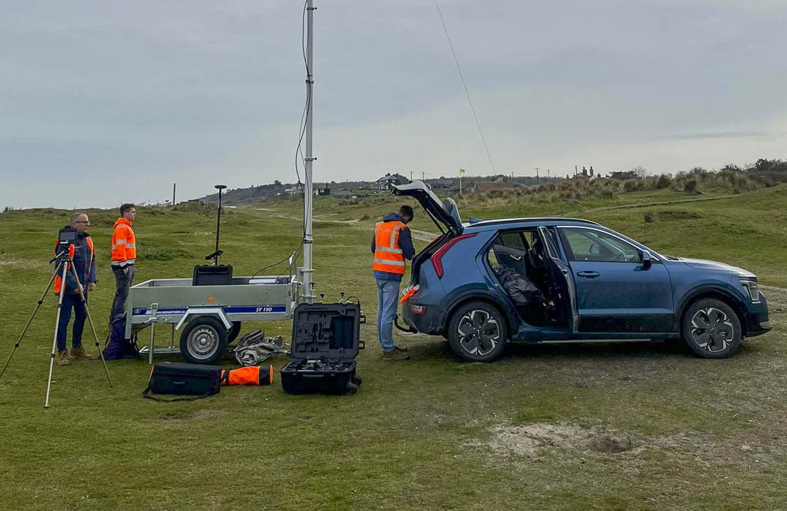
Plan
Remote or on-site mission planning, including safety, permissions (CAA/BVLOS approvals), and site risk assessments.
Capture
Automated multi-sensor missions using hardened UAVs and defence-tested payloads.
Process
Real-time upload into secure cloud storage with automated model creation.
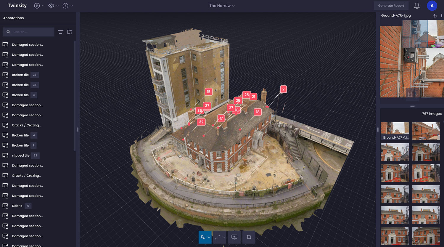
Analyse
AI-enabled defect detection and condition scoring through the MAYNE dashboard.
Report
Spatial reports, comparative models, and maintenance recommendations.
< Outputs >
What you receive.
Clients receive a secure, cloud-based construction data intelligence platform that turns drone survey and site monitoring data into practical, decision-ready outputs - accessible to project, commercial, and executive teams.
01
Interactive Analytics Dashboard
02
High-Resolution Visual Records
03
Survey-Grade Data Outputs
04
Progress, Quantity, and Compliance Reports
.webp)
< Benefits >
Project impact.
Stronger Cost Control
- Accurate quantity and progress data reduces overruns and commercial disputes
- Early issue detection avoids costly late-stage corrections
- Clear visual evidence limits change order escalation
- Improved cost certainty protects margins throughout delivery
Improved Programme Performance
- Real-time progress visibility highlights delays early
- Objective completion data reduces programme disputes
- Better trade coordination improves site productivity
- Faster, evidence-based decisions maintain momentum
Higher Build Quality
- Automated checks verify work against design intent
- Early identification of defects reduces rework
- Comprehensive visual records support inspections and audits
- Complete as-built documentation lowers handover and FM costs
Lower Risk and Stronger Claims Defence
- Time-stamped site records provide indisputable evidence
- Clear documentation supports scope and schedule disputes
- Stronger compliance records reduce liability exposure
- Improved risk mitigation supports insurance and warranty claims
< Case Studies >
What we've accomplished. Real solutions from real projects.


Find answers about how StirlingX works and what to expect.
Need more information? Reach out to discuss your specific situation.
How accurate are volumetric calculations for pay quantities?
Can you survey in all weather conditions?
What file formats do you deliver for BIM integration?
How does pricing work for construction projects?
Build Better With Better Data.
Learn how continuous project intelligence improves outcomes and protects your investment.