
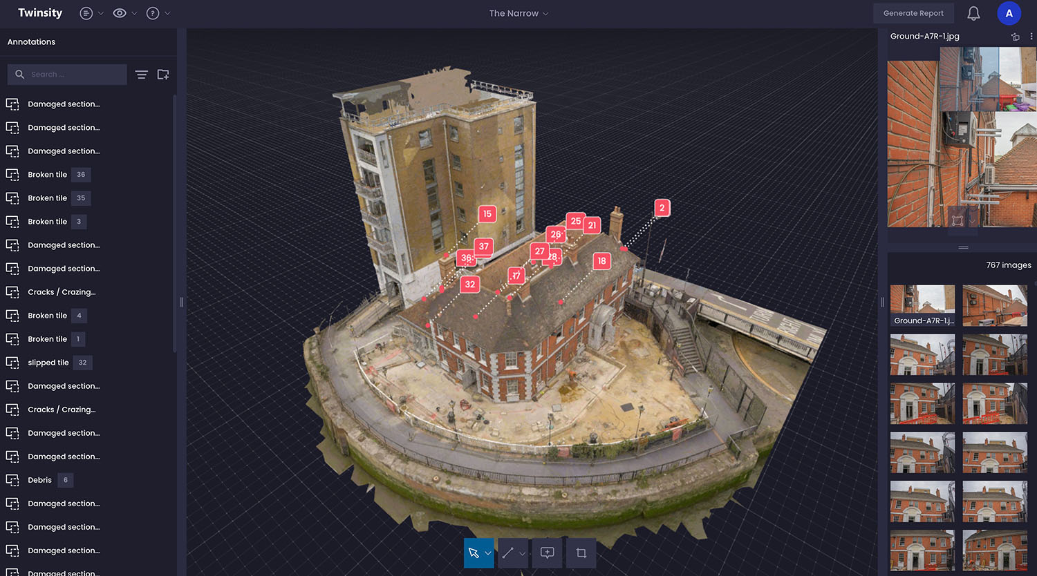
The Problem
Gordon Ramsay’s ‘The Narrow’ restaurant sits adjacent to the River Thames and beneath tall neighbouring apartments, making roof access challenging and risky. Surveyors needed a way to safely inspect roof conditions and plan scaffolding or MEWP access without repeated physical visits.
The Solution
- Combined aerial drone imagery with ground laser scan (TLS) data to create a highly accurate 3D Digital Twin.
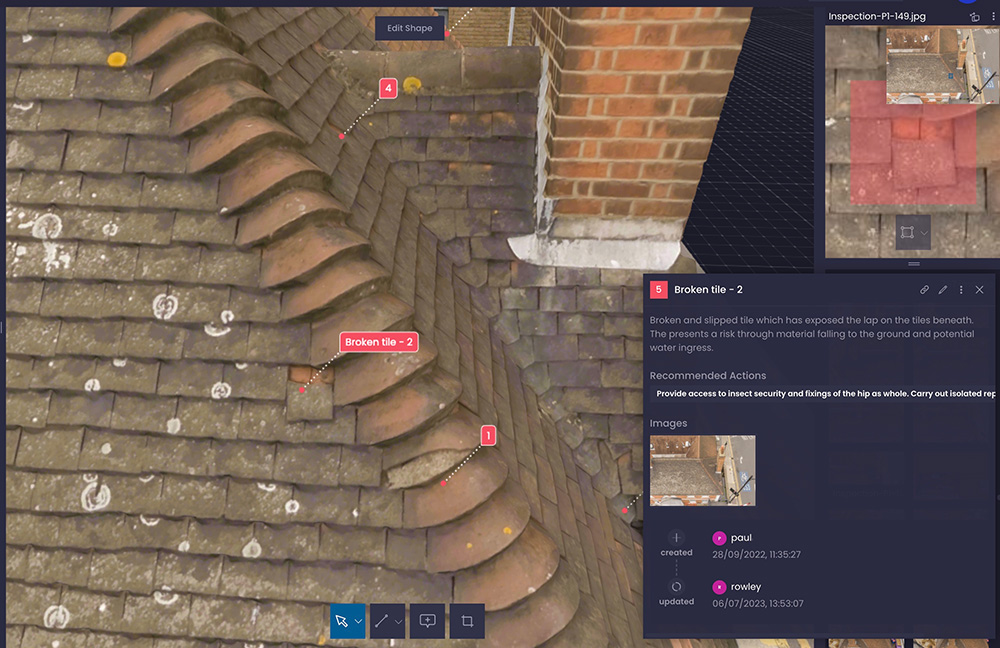
- Used the Twinspect platform to allow surveyors to navigate the model, annotate points of interest, and link directly to original high-resolution images.
- Coordinated closely with residents and maintained visual observation for safe drone operation in a constrained environment.
- Enabled distance and area measurements for planning and quantity take-offs.
Outcomes
- Surveyors could carry out detailed desktop inspections safely and efficiently.
- Annotations were geo-referenced,eliminating duplicate reporting errors.
- Facilitated focused physical access and preparation for refurbishment works.
- Generated PDF condition reports and shared digital models with multiple teams while maintaining controlled access.
