< Asset Inspection & Condition Monitoring >
Actionable insight into asset condition, captured safely and consistently.
High-resolution, multi-sensor inspections for critical infrastructure and commercial assets delivered safely, rapidly, and with defence-grade accuracy.

< OVERVIEW >
Drone asset inspection services for UK critical infrastructure.
StirlingX runs drone asset inspection programmes for critical infrastructure across the UK. Our pilots use hardened UAVs and defence-tested sensor payloads to inspect wind turbines, bridges, rail assets, industrial sites and rooftops, capturing high-resolution RGB, thermal, LiDAR and multispectral data in a single mission.
We combine BVLOS-approved aerial inspection with AI-led defect detection on the MAYNE platform, so operators get evidence-based intelligence on asset condition without sending personnel into hazardous or hard-to-reach environments.
< Key Applications >
Drone asset inspection services we provide.

Structural drone inspections. Routine drone inspections of bridges, buildings, towers and chimneys to detect cracking, corrosion and structural deformation.

Aerial condition monitoring. Repeatable drone inspection programmes for ongoing asset condition monitoring across road, rail, telecoms and energy networks.

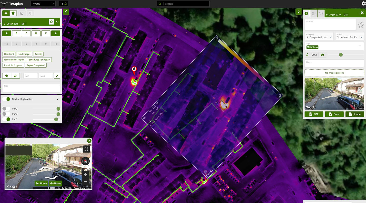
Thermal and LiDAR inspection. Thermal, LiDAR, RGB and multispectral aerial inspection in a single flight, with co-registered outputs in the MAYNE platform.

UAV inspection of hard-access assets. UAV inspection of wind turbines, transmission lines, offshore structures and confined spaces, eliminating scaffolding, rope access and shutdowns.

Defence and secure-site inspection. Asset inspection services for defence sites, MOD-adjacent facilities and critical national infrastructure where standard providers don't qualify.
< Process >
How we work.
Plan
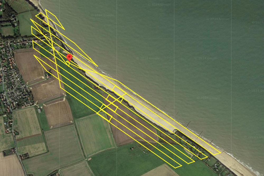
Every drone inspection starts with a thorough mission design. We review your asset type, site conditions, and inspection objectives before we arrive on site, then build a flight programme covering sensor selection, altitude and overlap parameters, and access logistics. Where BVLOS operations are required, we draw on our CAA approvals to plan beyond visual line of sight across wider corridors or restricted airspace. A full site risk assessment and method statement are produced before every inspection.
Capture
Our pilots deploy hardened UAVs carrying whichever combination of payloads the asset requires: high-resolution RGB cameras, thermal and infrared sensors, LiDAR scanners, or multispectral instruments. Each flight runs on pre-planned automated paths, so coverage is consistent across repeat drone inspections and datasets are directly comparable over time. For assets in hazardous, confined or hard-to-access environments, we configure the mission so no personnel are placed at risk.
Process
Captured data uploads directly into encrypted, ISO-certified cloud storage at the end of each mission. From there, automated pipelines produce geo-registered 3D models, point clouds, orthomosaics and thermal maps without manual intervention. This means processed outputs are available within hours of a flight completing, rather than days. All data is retained in a structured, time-stamped archive so every future inspection can be compared directly against baseline models.
Analyse
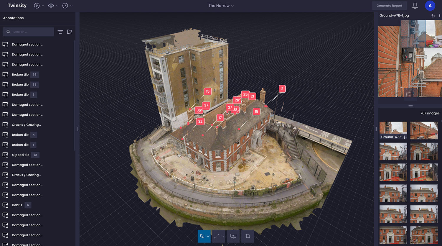
Processed data feeds into the MAYNE platform, where AI-enabled defect detection runs against the full dataset. MAYNE identifies and classifies defects, including cracking, corrosion, deformation and thermal anomalies. Every finding is geo-located against the asset model, so your engineers can see exactly where a defect sits without returning to site. Condition scores update each time a new drone inspection runs, building a clear picture of how the asset is changing over time.
Report
Clients receive structured inspection reports alongside the underlying spatial data. Reports include annotated defect imagery, comparative models showing change since the last inspection, condition scores by asset zone, and prioritised maintenance recommendations. Outputs are formatted to meet audit and regulatory requirements, and can be exported into your existing asset management systems.
< TECHNOLOGY STACK >
The foundation that powers your operations.
StirlingX runs on infrastructure designed for reliability and speed. Our platform integrates seamlessly with what you already have, no rip and replace required.

High-resolution RGB inspection cameras

Thermal/IR sensors for hotspots and energy loss

LiDAR scanning for structural modelling

Encrypted mission communications
BVLOS-VM approvals for wide-area inspection

MAYNE: automated defect detection, trend analysis & asset scoring


< Benefits >
How we're different.

Earlier fault detection
Drone inspections catch corrosion, cracking and deformation weeks or months before manual surveys.

Improved safety
UAV inspection removes engineers from heights, confined spaces and live infrastructure.

Continuous monitoring
Drone-based condition monitoring across the asset lifecycle, not one-off surveys.

Regulatory-ready outputs
Inspection reports compliant with CAA, ISO and sector requirements.

Lower operational burden
Outsourced UAV inspection. No in-house drone hardware, pilot training or BVLOS licensing required.
“We’ve worked with StirlingX since 2019 and were delighted to award them this framework. Their ability to combine cutting-edge permissions, efficiency, and data integrity makes them an invaluable partner.”
“The ability to pinpoint exact defect locations was invaluable given the size of the roofs. Data management is much easier.”
< Case Studies >
What we've accomplished. Real solutions from real projects.


Find answers about how StirlingX works and what to expect.
Need more information? Reach out to discuss your specific situation.

How long does implementation take?
Will this disrupt our operations?
What about our existing systems?
How do you measure success?
What support continues after launch?
Ready to move forward?
Get in touch with our team to discuss your specific needs today.