When BT confirmed the sale of the BT Tower to MCR Hotels, the clock started on a building that has stood on the London skyline since 1964. Before the conversion into a hotel could start, BT needed a precise digital record of the structure for archival and heritage purposes. To achieve this, BT commissioned StirlingX to conduct the work.
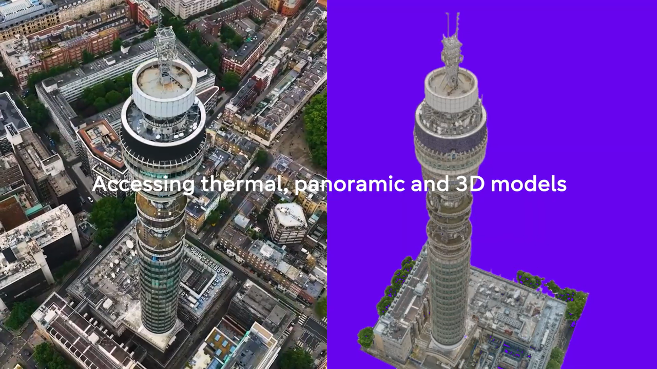
The brief was straightforward in principle, complex inexecution: produce a full photogrammetric survey of one of the UK's most recognisable structures, in the middle of central London, with the fidelity to support both archival and operational purposes. The result is high resolution 3D model to 2mm GSD, built from high-resolution imagery captured across the full height of the tower, including the 23 satellite dishes still mounted on its structure.
Flying drones over central London isn't something most operators can easily do. StirlingX holds CAA permissions for operations over uninvolved persons, which made it possible to conduct the survey without closing roads or disrupting the surrounding area. That approval was the operational foundation for the whole project.
The data was processed using Reality Scan, Epic Games' photogrammetry platform, and BT subsequently pushed the model into Unreal Engine for visualisation which renders it with realistic lighting, textures, shadows and materials, to create a a detailed virtual version of the tower.
The high rendering fidelity which enabled an accurate, realistic, and detailed 3D environment goes well beyond what traditional Computer-Aided Design (CAD) or Building Information Modelling (BIM) viewers produce. It also means the model isn't static: BT has an asset they can revisit, update, and use across different workstreams as the conversion progresses.
There's a practical dimension too. With complex equipment still on site, having a precise inventory of what's physically present at height, captured without scaffolding or rope access, gives the decommissioning team a working reference before anyone goes near the structure.
The project sits at the intersection of several things StirlingX does routinely: complex urban airspace operations, high-fidelity asset capture, and producing data that gets used downstream rather than filed away. Congratulations to BT Group on reaching this milestone with an iconic piece of British infrastructure.
Powering precision drone surveys with BT’s Drone SIM - YouTube
