
The Problem
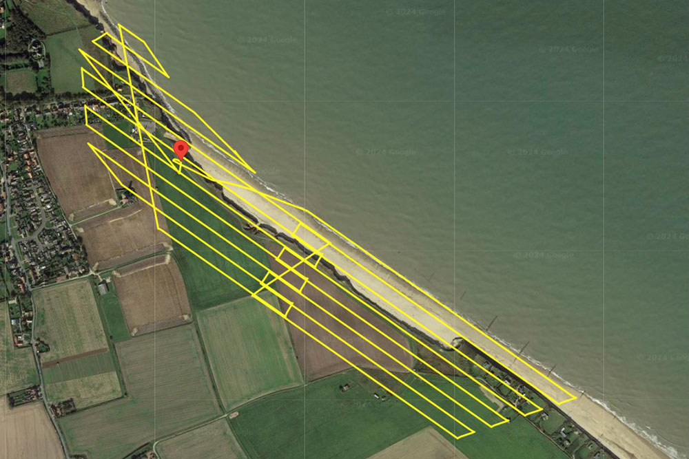
The Happisburgh coastline is highly dynamic, with beach levels and cliff profiles changing rapidly. Capturing accurate data within the short tidal window around low spring tide made traditional ground surveys impractical. Vattenfall required a fast, precise, and safe solution for repeated surveys across a wide intertidal area.
The Solution
StirlingX used RTK-equipped drones and temporary Ground Control Points to capture high-resolution imagery for photogrammetric processing. Initially flying with a DJI Phantom 4 RTK, we later transitioned to the DJI M300 RTK with a P1full-frame sensor. Our ‘hand-over, take-over’ dual-pilot method and the M300’s extended endurance enabled efficient coverage, while hot-swapping batteries eliminated downtime and minimised site movement. Continuous innovation reduced survey time from 2 hours 30 minutes to just 30 minutes per session - without compromising accuracy or safety.
Outcomes
- Four quarterly surveys delivered across 12 months
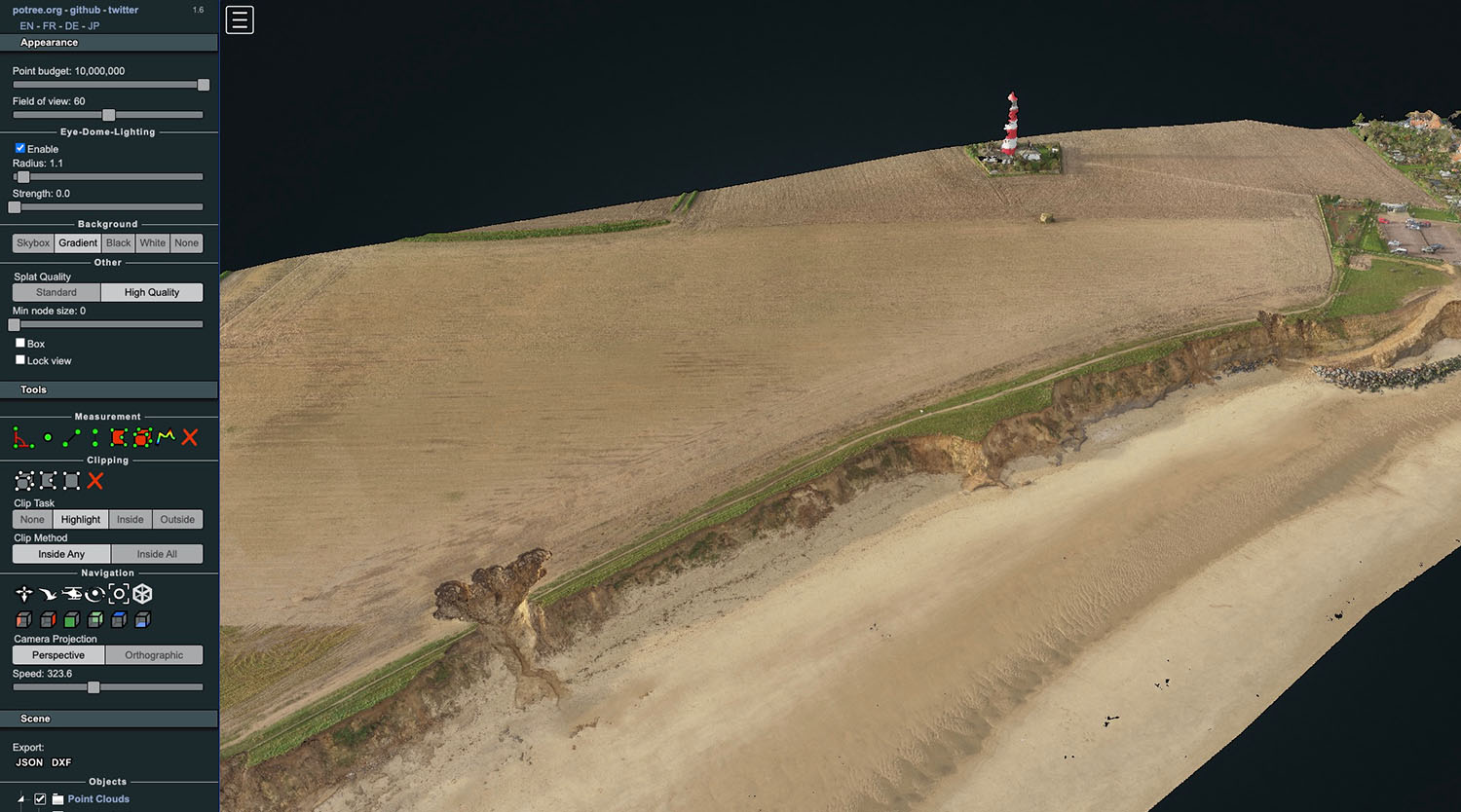
- Accurate 3D point clouds and terrain data for erosion analysis
- Survey time reduced by 80% through technology and process improvements
- Minimal public disruption and enhanced operational safety
Result: Faster, safer, and more accuratecoastal monitoring to support critical infrastructure planning.
