

The Problem
The plants had expansive, fragile roofs with no safe access. Scaffolding or MEWPs were impractical and costly. Thousands of isolated images would offer little value—our client needed accurate, navigable, and contextualised data for desktop inspections.
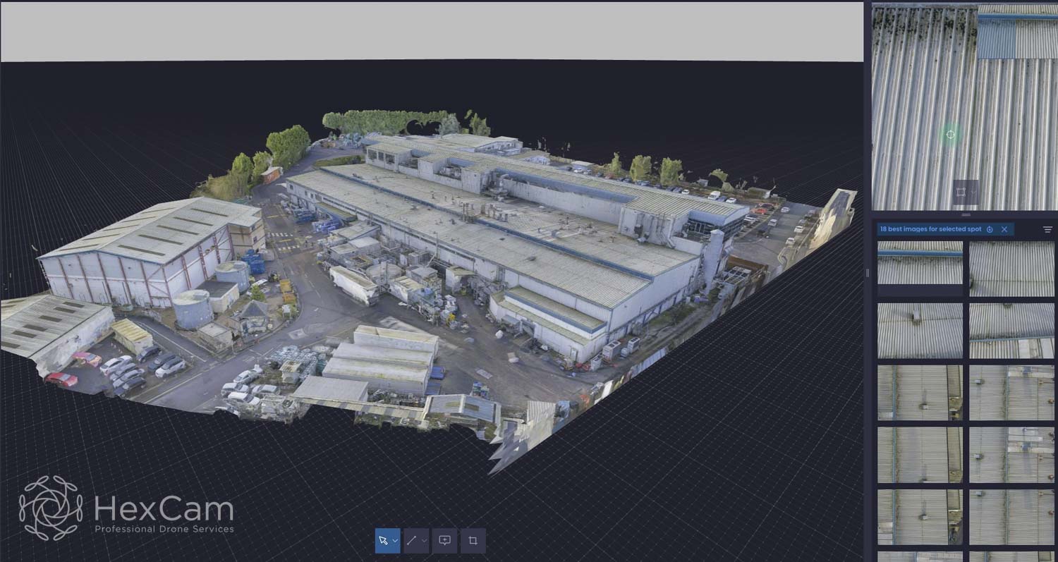
The Solution
UsingDJI M300 drones with P1 sensors, we achieved full coverage from multiple anglesfor all roof areas, creating a perfect dataset for 3D modelling. Our enhancedCAA permissions allowed flights as close as 10m to uninvolved people andseamless control handovers between pilots—minimising disruption.
We processed the imagery into Twinsity’s Twinspect platform, giving surveyors intuitive 3Ddigital twins with linked high-resolution images. Clicking any point in the model reveals precise source images, maintaining situational awareness.
Outcomes
Hamson Barron Smith now conducts comprehensive rooftop surveys remotely, eliminating working-at-height risks. Defects can be annotated directly in the 3D model, streamlining reporting and enabling precise planning for future access or remedial works.
